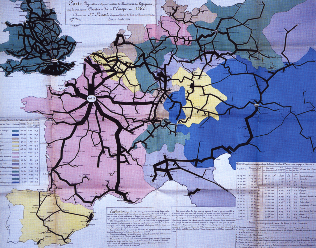
So I continue with another image that represents a significant entry in my network history The Connectivity of Things: Network Cultures since 1832. The book came out on October 15, by the way. Chapter 4 follows the twisted paths of Saint Simonianism. Yet, this week’s image is not as ambivalent as the rest of the chapter which deals with early socialism’s colonial ambitions. Polytechnicien Charles Joseph Minard’s 1862 statistical map of European railroad traffic rather underscores the Saint-Simonian ambitions for a mobilized industrial Europe. Minard’s other statistical maps and diagrams have become a classic in the history of visualizing information. But this image primarily expresses the ambitions of Saint-Simonianism to create a vibrating infrastructural network for the good of society.
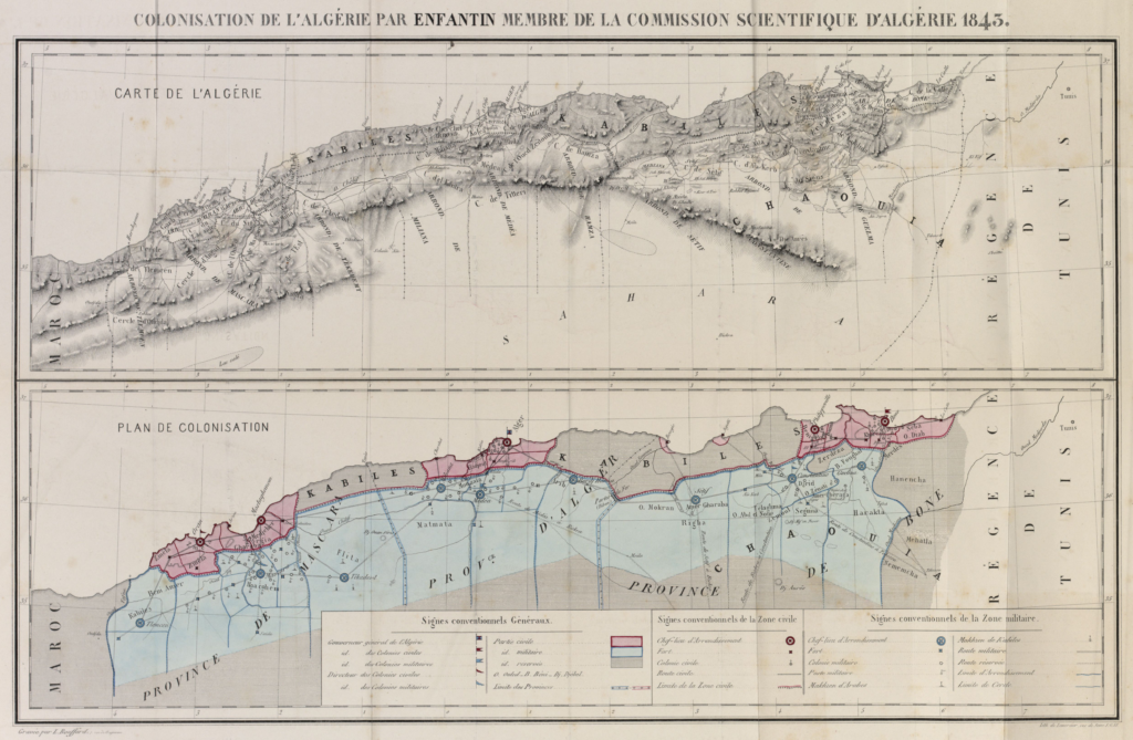
Prosper Enfantin: Colonisation de l’Algérie
This week’s image from The Connectivity of Things is a colonialist map. It was published as a fold-out part of Prosper Enfantin’s 1843 book Colonisation de l’Algérie. In this treatise, the Saint-Simonian cult leader Enfantin was upfront about the strategic placement of settlements and settlers in Algeria. While the early socialist movement of Saint-Simonians movement had started with utopian dreams of a new networked unity of orient and occident in the 1830s, this map deliberately drew a reséau de soumission –– a network of colonial submission and police power.
Chapter 3 of the book is focused on theory and heuristics of writing network history in „An Archive of Networking.“ Yet, this map features prominently in chapter 4 of the book. It is called „Channels: The Politics of Networking around 1850,“ and it deals with the ambivalent history of network ideology and practice in early socialism. There’s not just a breathtaking colonial history to be told here –– which includes the Suez Canal –– but also one of early feminism, romanticism and social engineering. I’ll come back to the Saint-Simoniennes and Saint-Simoniens next week.